
The varied and spectacular terrain of Australia is a bushwalkers’ paradise. From the mountains to the Red Centre, the coast to the forest, this issue features four of the many popular walking tracks for hikers that traverse the country.
Designer
MDM Design
Products released in this issue
- Stamp (4 x 70c)
- Minisheet
- Cover (blank)
- First day cover (gummed)
- First day cover (s/a)
- First day cover (minisheet)
- Stamp pack
- Maxicard (4)
- Medallion cover
- S/A booklet of 10 x 70c
- Chequebook of 20 x 10 x 70c
- Roll of 100 s/a
- Strip of four
- Collector pack (the last collector pack released)
- Gutter (10 x 70c) with design
Technical specifications
- Issue date
- 14 July 2015
- Issue withdrawal date
- 31 January 2016
- Denominations
- 4 x 70c se-tenant
- Stamp design
- MDM Design
- Product design
- Sharon Rodziewicz, Australia Post Design Studio
- Printer
- Bambra McKellar
- Paper - gummed
- Tullis Russell
- Paper - self-adhesive
- C100
- Printing process
- Lithography
- Stamp size
- 37.5mm x 26mm
- Minisheet size
- 170mm x 80mm
- Perforations
- 13.86 x 14.6
- Sheet layout
- Module of 50
- FDI postmark
- Walkaway, WA 6528
- FDI withdrawal date
- 11 August 2015

The six kilometre long National Pass in the Greater Blue Mountains World Heritage Area of New South Wales. It lies 100 kilometres from Sydney and is easily accessible by car or train. This popular walk takes walkers through rainforest gullies, cliffs and waterfalls, including the Princes Rock Lookout with views over the Wentworth Falls and Kings Tableland. The trail was built with picks, shovels, crowbars and dynamite between 1906 and 1907 and was officially opened in 1908. It was the first official walking track open to the public in the region and continues to attract thousands of visitors every year. The walk is rated moderate in difficulty and can be completed on around three hours.

The Cape to Cape Track runs for 135 kilometres along the Western Australian coast between Cape Naturaliste in the north and Cape Leeuwin in the south. It is noted for spectacular coastal scenery, including beaches, rocky outcrops, secluded bays and regions of great significance to the local Indigenous communities. The entire walk is challenging, taking five to seven days; however there are easier sections that take from half a day to a day to walk. The track was officially opened in 2001.

The Larapinta Trail in the Northern Territory follows the West MacDonnell Ranges for 223 kilometres between Alice Springs and Mount Sonder, one of the territory’s highest mountains. The walk includes many sites sacred to the Arrernte people, who have permitted tourists to visit. Walkers of various abilities can undertake appropriate sections of the trail. The many impressive natural formations along the trail include Simpson Gap, Stanley Chasm, Ormiston Pound, Ellery Creek Big Hole and Glen Helen Gorge.

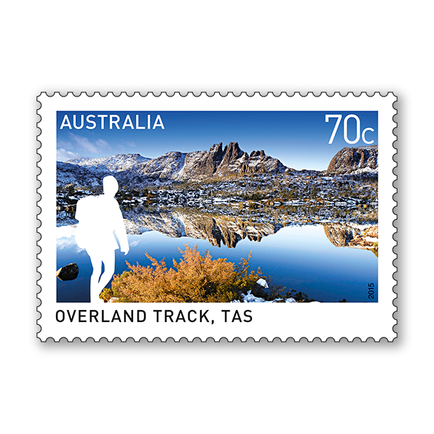
The Overland Track winds for 65 kilometres between Cradle Mountain and Lake St Clair in the pristine Tasmanian Wilderness World Heritage Area. Sights include rainforest, rivers, alpine plains, lakes and mountains. Many of the 8,000 walkers who complete the track every year also hike along Lake St Clair, adding some 17 kilometres to the walk. Other side tracks include to the summits of Cradle Mountain and Mount Ossa and to the group of tarns called the Labyrinth. The walk is generally completed in five to six days, usually north to south, which is the mandatory direction between October and May.


This content was produced at the time of the stamp issue release date and will not be updated.