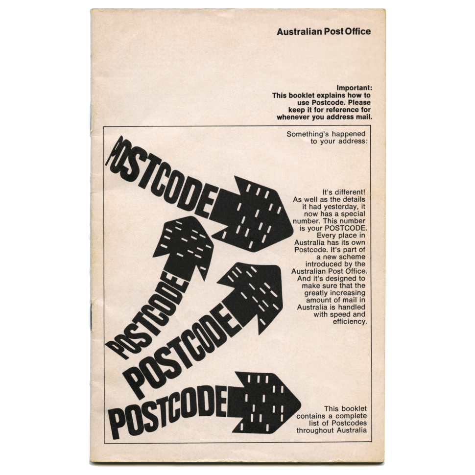
Australia’s system of postcodes was introduced on Saturday, 1 July 1967, 50 years ago. Four digit postcodes were developed for electronic mail handling equipment at the former Redfern Mail Exchange in Sydney.
At the time, addresses on letters were read by skilled mail sorters equipped with a detailed knowledge of geographical localities. But with about 8,000 delivery offices, it required at least two or three stages of sorting to get letters to their destinations.
Postcodes simplified the sorting process. Coding operators pressed keys corresponding to the postcode, which enabled the letters to be sorted electronically and despatched to their delivery offices. In 1967, nearly 5,000 postcodes were allocated to every city, town, suburb and small centre across Australia.
The allocation of postcodes followed a broad geographical pattern. Postcode numbers for capital city suburbs began in the west and moved to the north, east and south; a similar pattern being followed for country areas. The first digit corresponded to radio station call signs: 2 (New South Wales), 3 (Victoria), 4 (Queensland), 5 (South Australia), 6 (Western Australia) and 7 (Tasmania).
In July 1967, the first edition of the Postcode Booklet was distributed free by mail to every Australian household and business address. A total of 4.5 million booklets were distributed, as well as a postcard identifying the recipient’s own postcode. A year after postcodes had been introduced, over 70 per cent of mail articles featured the postcode.
Postcodes today
During the past 50 years, additional postcode ranges have been allocated for post office box installations, Large Volume Receivers (those who receive large amounts of mail) and other special uses, such as competitions.
Current postal ranges for the states and territories:
New South Wales
1000 to 2599
2620 to 2899
2921 to 2999
Victoria
3000 to 3999
8000 to 8999
Queensland
4000 to 4999
9000 to 9999
South Australia
5000 to 5999
Western Australia
6000 to 6999
Tasmania
7000 to 7999
Australian Capital Territory
0200 to 0299
2600 to 2619
2900 to 2920
Northern Territory
0800 to 0999
Australia’s external territories have postcodes in the states that coordinate their mail deliveries: Norfolk Island (2899), Christmas Island (6798) and Cocos (Keeling) Islands (6799).
The current postcode listing features 15,000 place names. The PDF file is updated quarterly and it’s freely available at the Australia Post website: auspost.com.au/postcode
Postcode envy?
Here are some postcodes that residents should have no problem remembering:
- Attunga and Garthowen, New South Wales: 2345
- Noosa Heads, Queensland: 4567
- Penshurst, New South Wales: 2222
- Meredith and Bamganie, Victoria: 3333
- Hope Gap, Lake View, Mundoora, Tickera, Alford and Collinsfield, South Australia: 5555
This article was produced at the time of publication and will not be updated.


